 Today’s edition of TDI Friday Read compiles some previous posts featuring maps we have found to be interesting, useful, or just plain cool. The history of military affairs would be incomprehensible without maps. Without them, it would be impossible to convey the temporal and geographical character of warfare or the situational awareness of the combatants. Of course, maps are susceptible to the same methodological distortions, fallacies, inaccuracies, and errors in interpretation to be found in any historical work. As with any historical resource, they need to be regarded with respectful skepticism.
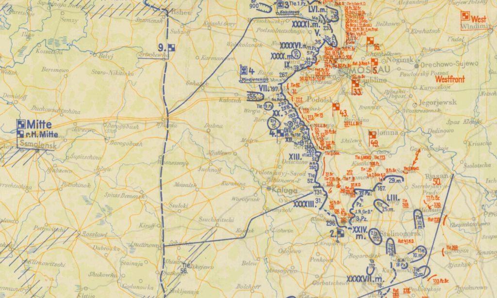
Still, maps are cool. Check these out.
As an added bonus, here are two more links of interest. The first describes the famous map based on 1860 U.S. Census data that Abraham Lincoln used to understand the geographical distribution of slavery in the Southern states.
The second shows the potential of maps to provide new insights into history. It is an animated, interactive depiction of the trans-Atlantic slave trade derived from a database covering 315 years and 20,528 slave ship transits. It is simultaneously fascinating and sobering.